 Multi-GNSSProviding real-time corrections for cm-level PPP w/ ambiguity resolution |
 High PrecisionPPP, RTK server and client software for demanding GNSS applications |
 NetworksGlobal and regional networks for SSR, monitoring, and network RTK |
 AtmosphereEnvironmental monitoring for the troposphere and iononsphere |
 Precise OrbitsOrbits for low-Earth satellites in real-time or post-processed at the cm-level |
Software Brochures


Examples of GNSS Derived Products for Weather Forecasting
Near Real-Time PWV from the RTNet GPS-MET Service
| RTNet NRT PWV in US | RTNet NRT PWV in CONUS |
 |
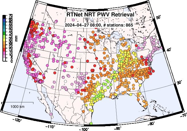 |
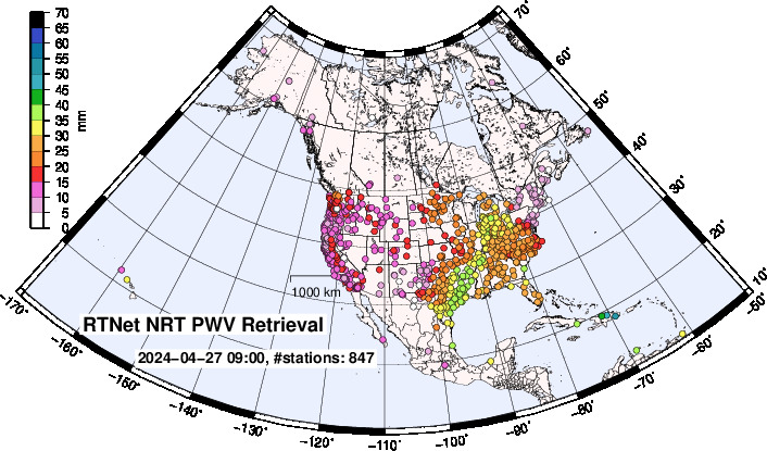
(Left): Near-real-time PWV estimates for stations located in North American. (Right): Same as the map on the left but showing only the contiguous United States. These products have a typical latency of 18~60 minutes. The delay in the availability of the public RINEX data is the primary driver of the latency. We are currently processing 1,362 stations. Any data that arrives within a specified period is processed and included in the current epoch.
The near-real-time RTNet PWV service can process GNSS stations (using RINEX or real-time data) from any global location. We use high-quality multi-GNSS satellite orbit and clock products. The PWV and slant delay products are then made available to our end-users.
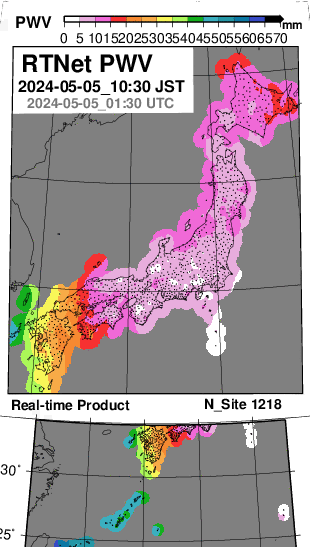
Real-Time PWV with RTNet GPS-MET System
| Realtime PWV Monitoring | Current Rainfall Analysis |
 |
Rainfall derived from radar and rain gauge data |
